Monday, 14 March 2016

Fantastic Winter Sunshine on the Harlech Coast

Snowdon, capped with snow, from the Glastraeth marsh.
Now that the Wales Coast Path is well established, Peter is looking at extending our walking holidays further south as far as Aberystwyth. Consequently he asked me to get out from behind a desk into the glorious March sunshine last Thursday, and do a recce of the route from Llandecwyn, near the old toll bridge, to Llanbedr a few miles south of Harlech. I know, it's a tough life isn't it!


I initially drove down to Llanbedr and parked at the little free car park near the train station. I then hopped on the train and headed north to Llandecwyn. Conveniently, both stations are just yards from the coast path route. The initial few hundred ran alongside the main road until a signposted left turn that took me across fields to the edge of the Glastraeth salt marsh.

Is this the best view from a station platform in Britain?

The craggy hills on your left as you walk south from the station.

As the path heads south it widens out into an easy to follow track at the edge of the Glastreath marsh.

I'm happy to report that the path is mostly very well signed, with lots of roundels with the distinctive Wales Coast Path logo to make sure that you never get too far off track.

A slightly weather-beaten bridge, but sturdy enough.
The path eventually heads uphill onto a little elevated region called Ynys, or island in Welsh, possibly because it stands proud of the surrounding flatter land. Near the top is this charming little church, standing all alone surrounded by fields.

The interior of the church has beautiful engraved beams and a very colourful stained glass window.
Ynys' elevated position gives it a splendid view of Portmeirion across the estuary.
The hills of the Llyn Peninsula seem very close.
The next change of scenery is a long straight path along the edge of the Morfa Harlech woodland.
Following the slightly confined path through the woodland it opens out into a wide open field and heads towards Harlech itself in the distance.
Harlech Castle
From Harlech the path heads straight to the coastline through the golf course and then the dunes. 
The weirdly alien landscape of the dunes.
The next stage is a long pull across Harlech beach to the headland in the distance. The path then heads up a set of steps to cross the rail track before a steep zig-zag climb to the top...
... where you are rewarded with this fabulous view.
After feeling pleased with myself for making that steep climb, I then lost all that height on a long downhill slope to Llandanwg. It was worth it though for the little old church surrounded by the sand dunes. Handily, there is also a little cafe and some toilets.

Llandanwg's tiny church

The interior with its gnarled and worm eaten beams - I'm not sure whether they're still load bearing or just there for atmosphere now.

After leaving the church the path took me through this little marina area,

Next came this nice metal bridge across the River Artro

I know you're not supposed to take photos into the sun, but I thought this was rather pretty.

The home stretch beside the babbling River Artro.

A sight for sore knees! Back where I started that morning.
My total distance that day was 12 miles. It was a great experience on such a lovely day, and I'm thoroughly looking forward to the next section from Llanbedr to Fairbourne. I'll be posting images from that walk later this week.

Friday, 11 March 2016

How low can you go?

Yesterday low tide was set for 16:04. It was set to be the lowest tide of the year - 0.0m. There was also very little wind and a very calm sea. So, these photographs show Aberdaron beach at the lowest tide you can realistically expect ever to see.

Aberdaron beach on March the 10th at the very low point of the tide. A mile of sand with hardly a person to be seen in the winter sun.


Low tide exposes the remains of Aberdaron pier. This was not a tourist attraction but a large loading pier for ships extracting the granite which was mined behind it. Unfortunately for the investors the market for granite collapsed in 1925 and the quarry was abandoned and the pier cut down. It stood at a heights of something like 10m to enable boats to come in on the high tide and load up with rock whilst sitting on the sand but lashed to this structure.


Low tide also exposes different sorts of seaweed not normally seen.

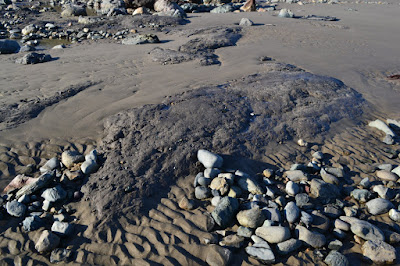
There are no dinosaur footprints or petrified forests on Aberdaron beach but you will see the compacted clay which underlies the sand and shingle.

This is Carreg Ring. A huge boulder referred to as "the big rock" and normally seen only from the shoreline.

There were a lot of Oystercatchers on the beach that seemed to move around in groups, but this little fellow was all on its own. Any ideas what it is?

Aberdaron beach from the east. There are large caves here and much exposed rock, and some lovely rock pools with fish in them. Just a mile back for that first pint at the Ship.


Monday, 22 February 2016

Julia Bradbury doing her bit for North Wales


If you didn't see the program on the beautiful walk that presenter Julia Bradbury took to Llanddwyn Island on Anglesey then it's well worth checking out online. You'll have to be quick though as it's only available for another 27 days or so. You can find a link to it here.

While the programme did an excellent job of showing off the magnificent view of the Llŷn Peninsula across the Menai Strait, the one area that it fell down was Julia's pronunciation of Welsh words. Julia even admitted during the show, and later on twitter, that she regretted her inability to pronounce them properly. Even we, as incomers to the area, winced a little when she referred to the "Thlun" Peninsula, so we can only imagine how a first language Welsh speaker might feel. To help any fellow learners out, we thought we'd offer some tips on how we learned to make a reasonably good pronunciation of the word.

If you break down the word Llŷn into its components is's actually not difficult. The initial double-l is a letter in its own right in Welsh, so Llŷn is really just a three letter word. The best way to pronounce it is to put your mouth into the shape you would use to say l, but then put your tongue behind your top front teeth and hiss. This sound doesn't exist in English, but if you find it difficult you can cheat a little and pronounce it as though it starts with a "th". It's not quite the same though.

The next part is the y with a little hat over the top of it that is commonly known as a "to bach" or "little roof". Y is actually considered a vowel in Welsh and so helps glue the consonants at the beginning and end of the word together. Vowels in Welsh can sometimes sound similar to each other and in this instance the y is pronounced a bit like the letter i in the English word "it", but with the to bach indicating that the sound should be elongated, like a double letter in English. (This is actually important because the word Llyn, without a to bach, is pronounced differently and is a completely different word meaning "lake").

Lastly the n is very easy as it is pronounced just the same as in English. Put them all together and it comes out a little like "Thliin". To be really authentic you need to develop a proper Welsh accent and perfect the double-l hissing sound, but at least the above is reasonably close.

Welsh spelling can seem a little daunting to English speakers at first glance, but as you become more familiar with it you realise that it is actually quite consistent, with letters usually making the same sound wherever they are found and with very few silent letters. The few exceptions we can think of are the silent g in the word "gwlyb" - meaning wet, and the slight variation in how the letter y is pronounced depending on its place in a word - for example pronouncing Aberystwyth as "Aber-us-twith".

And let's face it Welsh is hardly the worst offender in this category. Why do we add all those extra letters in Gloucester when we're only going to say "Gloster"? Why isn't Arkansas spelled with a w? And why do we pronounce the Vale of Belvoir as though it's home to large, dam-building rodents? Answers in the comments please...?

One last comment, Julia, Anglesey is a special and beautiful place largely because it has great views of Snowdonia and the Llŷn. Please, next time, come over to the Llŷn and we will show you the real thing itself, something truly exceptional.

Thursday, 18 February 2016

Edge of Wales goes to Edge of London


Never willing to forgo the opportunity to promote our business, we were delighted to be invited to join the Visit Wales stand at the Telegraph Outdoor Show last weekend. This was held at the Excel Exhibition centre in a particularly soulless part of Docklands which could only be reached by using the Docklands Light Railway. Places such as Poplar look much less endearing from the train than they do on Call the Midwife.


The Show was very popular and the whole Welsh team worked hard all day promoting the delights of Wales. Peter worked alongside Rob Holt, Harry Corin and Claire Carew of Visit Wales, Huw from Caernarfon TIC and Mike Smart from Always Aim High. There was also staff from South West Wales from promoting Dirty Weekends and Celtic Coasteering- shown here on the left.


Dominating the huge stand was a giant video screen with scenic and action sequences which were jaw dropping and demanded attention.


These goggles were a great draw. When worn they put you in a world of your own and the scenery changed as you looked around.


Increasingly the Outdoor Show is a venue for cyclists who can drool over the latest technology in bikes, but there were also a lot of families some members of which were getting into mountain biking and these proved to be fertile ground for our two properties Manaros (which sleeps 8 in 4 en-suite bedrooms) and Glandwr (directly opposite the beach, sleeps 6 and perfect for families on a budget).


The emphasis on the Visit Wales stand was on adrenalin sports, as is most of the literature for Year of Adventure. We hope that the tourist authorities are aware of just how small a market this actually is. However, the stand caught the attention of passers by and, in conversation, we were able to reassure people that you didn't actually have to scare yourself stiff everyday in Wales. There are good things to do in walking, relaxing in cafes and on beaches and visiting places of interest.

Friday, 5 February 2016

Down in the Valley

In our last blog post we reported on how much the Wales Coast Path to the east of Aberdaron has been improved by moving it closer to the coast. While we were out we also checked out the section that connects Aberdaron to the start of the new route at Morfa Mawr. This path follows the river Daron at the bottom of its valley, and enables walkers to almost entirely avoid walking on tarmac roads. We walked it in an east to west direction back to Aberdaron. It's a very pleasant little valley, but the route can be muddy at this time of year. Walkers should take care as livestock can be found on some parts of the route.
After coming up from the coast we crossed the road at Morfa Mawr and followed the signposted route at the edge of the field to the kissing gate in the bottom left corner. We then continued downhill on the (at the moment muddy and slippery) slope to the bridge over the river itself.
This is the well-built wooden bridge that crosses the river Daron.

The river makes a few twists and turns as it lazily winds its way along the valley floor.

This was a particularly muddy section, but which should be dry in the summer.

As you can see it's quite a peaceful, pretty little valley.

This is where the route terminates back in the village. The path actually runs along the edge of the old, and now dry, mill-pond for the ruined water mill opposite the bakery.

Thursday, 21 January 2016

It doesn't get much better...

The weather has been brilliant today. A frosty start but wall to wall sunshine and clear views. The entire staff of Edge of Wales Walk went out to test the new sections of the Wales Coast Path to the east of Aberdaron.


We started from the valley beyond Llanfaelrhys church with the intention of walking to the coast and then heading back to the office in Aberdaron. We started with a walk along the stream past the manganese mines. These were very active during the First World War. See following blog.

On reaching the sea the landscape opens up dramatically with coastal views to the left and right. We headed west over the bridge (don't be tempted to cross the stream before this point, keep to the east of the stream.)


Walkers now have the opportunity of walking down to Porth Ysgo beach itself. There is a very good, but extremely steep, wooden staircase that enables you to do this. I wouldn't try it with a push chair! There is a lot of driftwood here and some sand. There is also a beautiful waterfall. Views towards Bardsey are enticing.


There are just enough signs to get by. Look out for the wooden posts with a white painted top and the blue and yellow seashell logo of the Wales Coast Path. Beware of walking on past one of the new black kissing gates. If you find a kissing gate then it's a pretty good bet that you are meant to go through it.
This is a photo looking back eastward. The long flat topped hill in the distance is Penarfynydd; which translates to Head or End (Pen) of the (ar) Mountain (mynydd, mutated to fynydd).

Here is the rock known as Maen Gwenonwy. It has been said that this rock (Maen) was named after Queen Guinevere, wife of the (legendary?) King Arthur who fought Mordred at the battle of Camlan, which is supposed to have taken place nearby, at a farm now called Cadlan. The wounded King Arthur was then taken to Bardsey Island, (perhaps Avalon) for medical attention before (possibly) sailing off to run the kingdom of Brittany. Place name evidence has its limitations!

Congratulations to the WCP team for the high quality fittings on this route. The gates are excellent and all the gorse on the path itself has been removed.

One of the treats on the walk is to come across ponies who do a good job keeping down the grass and bracken. In summer this is also a good stop to see the dolphins, chough and cormorants. Today we saw the snow capped peak of Cadair Idris in the distance.

Most of the walk is not too demanding. With all of the wet weather we have had there were a few muddy sections, but generally the path is in good shape and a real effort has been made to cut back the vegetation.

The path rounds Penrhyn Mawr (the headland to the east of Aberdaron) and comes out on the cliffs above Aberdaron beach. It would have been nice to have been able to walk down to the beach and approach Aberdaron from the seashore, but these cliffs are unstable and it would require a ladder worthy of St. Jacob himself.

The path heads inland towards Morfa Mawr farm, where you have the option of walking back to Aberdaron along the tarmac lane or heading down into the Daron valley (see following blog).

This is a fine path and, together with the weather, made for an unforgettable day. The WCP team and Gwynedd Council deserve a big thanks for all their hard work in creating and maintaining this path.